


Contents: 1. Map settings ↧ 2. Route information ↧ 3. Route planning ↧ 4. Detour ↧ 5. Recalculation ↧ 6. Completion ↧ 7. Automatic route planning ↧
After selecting a destination and planning a route, the system calculates the optimal route and begins navigation.
All information for movement along the route is presented on the navigation map in a clear and complete form. At the same time, you can set additional navigation parameters and set other navigation settings in the route navigation menu.
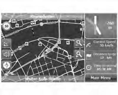
Figure 5.1 Free navigation map
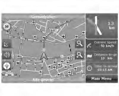
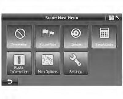
- Click "Main menu" ("Main menu" on the screen "Route Navi Map" ("Route Navigation Map") to go to the screen "Route Navi Menu" ("Route navigation menu").
Figure 5.2 Route navigation menu
1. Map settings
Figure 5.3 Map parameters
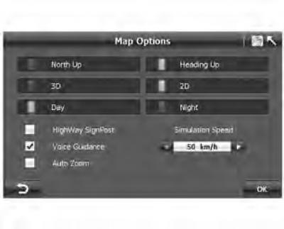
The settings can be accessed from both the Free Route Navigation Menu and the Route Navigation Menu.
The map settings functions are listed below:
Automatic map rotation
Figure 5.4 North up
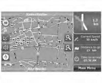
Figure 5.5 Direction of movement up
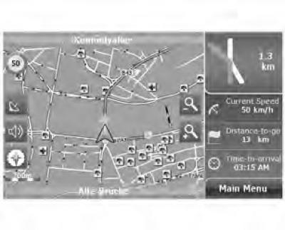
"Heading Up" (The motion vector is directed upwards): rotate the map according to the direction of movement.
"North Up" ("North Up"): The map is aligned so that it is always facing north, allowing you to see the road conditions ahead.
Figure 5.6 2D map
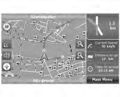
Figure 5.7 3D map
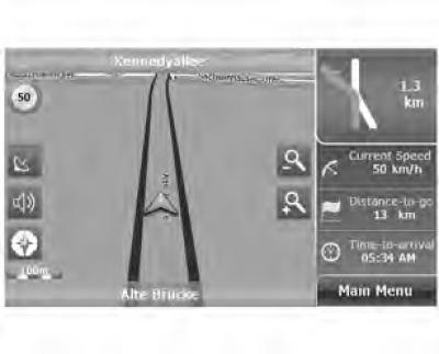
2D/3D: switch between 2D and 3D coordinates.
Figure 5.8 Daytime mode
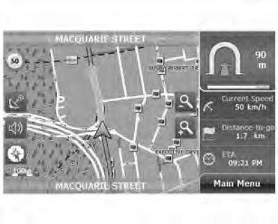
Figure 5.9 Night mode
Day/Night: Switch the color scheme between day and night.
Signpost: Enables/disables display of highway road signs on the map
Voice accompaniment:
- Lack of voice guidance at every turn.
- Voice guidance at every turn.
Automatic zoom:
- Automatically adjusts the map scale according to your speed and provides a better overview of the map.
- Changing the map scale manually.
Simulation Speed: Allows you to set the driving speed during the driving simulation. The simulation speed ranges are 50 km/h (mph), 100 km/h (mph), 150 km/h (mph), 200 km/h (mph), 250 km/h (mph), and 300 km/h (mph).
2. Route information
Figure 5.10 Route information
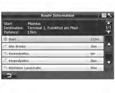
- On the screen "Route Navi Menu" ("Route navigation menu") (figure 5.4) click "Route information" ("Route Information") to display the entire route in text format (figure 5.10).
- Route information includes: start of route, distance, name of next street, distance between two turns and turn type. Example: drive 2 km along Kennedy Allee, then turn right at the intersection with Morfelder Landstrasse.
3. Route planning
Figure 5.11 Route plan
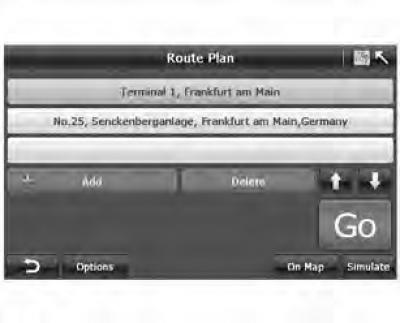
The A-Navi system allows you to change your destination or add multiple points during navigation.
- Click "Route Plan" ("Route plan"), on the screen "Route Navi Plan" ("Route navigation menu").
4. Detour
Figure 5.12 Detour
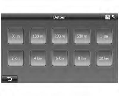
- On the screen "Route Navi Menu" ("Route navigation menu") tap "Detour" ("Detour") (figure 5.2), to go to the "Detour" screen (figure 5.12).
Figure 6.20 Detour
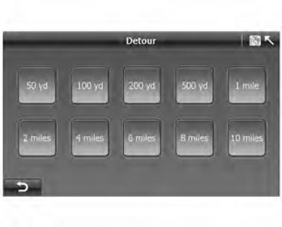
- If a traffic jam has formed at any point on the road, you can estimate the distance to the traffic jam and select the appropriate route, and the A-Navi system will calculate a detour route.
5. Recalculation
Figure 5.13 Recalculation
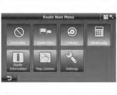
If you think the suggested route is not practical or want to see another route between your starting point and your destination, you can click "Recalculate" ("Recalculate") to go to the route recalculation screen.
6. Completion
By pressing the key "Terminate" ("Stop navigation") the system will automatically stop navigation and switch to the free navigation map.
7. Automatic route planning
To ensure maximum safety while driving, the A-Navi system offers an automatic route planning function, which is used in two cases:
- Automatic navigation start: Once the destination is set, the screen will show "Route Plan" ("Route Plan"), press "Go" and the A-Navi system will automatically start navigation. The procedure is described below:
- 0-1. If GPS signal is found, go to the next step. Otherwise, you need to wait for GPS signals to be received.
- 0-2. Set the current position as the starting point, and start navigation using the optimal route.
- Automatic rerouting: If you accidentally miss a recommended turn, the A-Navi system will start recalculating a new route after about 100 meters. This way, you will never get lost.
[Information taken from the official website: «CHEVYMAN.ru»]