


Contents: Setting ↧ 1. Volume ↧ 2. Warning: about danger ↧ 3. Registering route information ↧ 4. Managing your address book ↧ 6. Setting your home address ↧ 7. GPS status ↧ 8. Language ↧ 9. Right/left hand drive cars ↧ 10. Unit of measurement ↧ 11. Display driving speed ON/OFF ↧ 12. About the system ↧
Setting
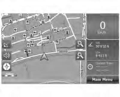
Figure 6.1 Free navigation map
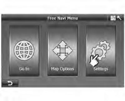
Figure 6.2 Route navigation map
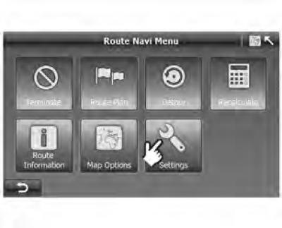
The settings provide a set of options that allow you to customize the A-Navi system to your requirements.
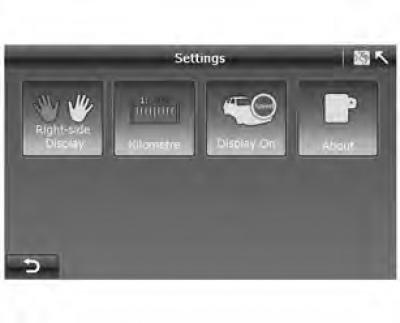
On the screen "Settings" ("Settings") in the Free Navi Menu ("Free Navigation Menu") or Route Navi Menu ("Route Navigation Menu"), there are 11 settings available.
Figure 6.3 Settings_1
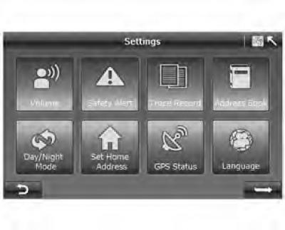
Figure 6.4 Settings_2
1. Volume
Figure 6.5 Volume
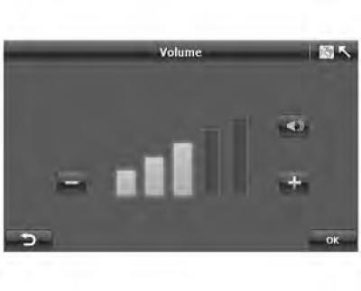
- Press "Volume" on the screen "Settings" ("Settings") (figure 6.3), to go to the "Volume" screen (figure 6.5).
- Press "-" to decrease the volume or "+" to increase the volume.
- Click
 , to turn off the sound.
After setting up the system, click "OK" and the system will save your settings and then return to the screen "Settings" ("Settings").
2. Warning: about danger
Warning: Speeding Warning is issued when you exceed the maximum speed limit on a given road.
This setting allows you to decide whether you want to receive a notification when you exceed the maximum allowed speed or not.
Figure 6.6 Hazard warnings
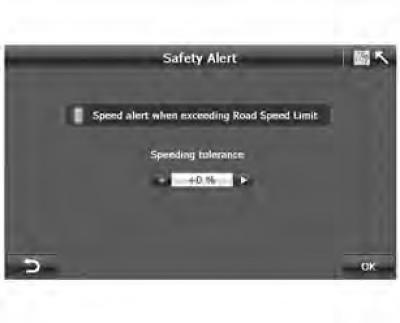
- Click "Safety Alert" ("Danger warnings") on the screen "Settings" ("Settings") (figure 6.3), to go to the screen "Safety Alert" ("Danger warnings") (figure 6.6).
When the speed limit warning is turned on, you can set the tolerance within 0%, 5%, 10%, 15% and 20%.
3. Registering route information
The A-Navi system records all positioning information received from the GPS receiver during navigation. The route is drawn on the map, allowing you to view the route history the next time you start the system. This feature is very useful when driving in sparsely populated areas such as deserts or forests.
Figure 6.7 Registering route information
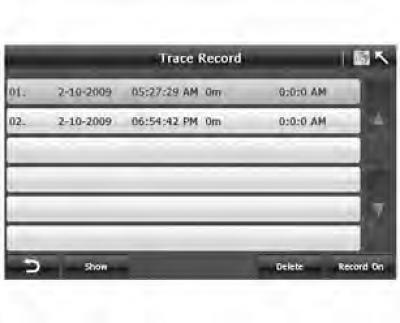
- Click "Record On" ("Enable Recording") to enable route recording, or "Record Off" ("Turn off recording") to turn off route recording.
- All the route records will be displayed on the screen. If you select one record and click "Show", the route record will be displayed on the screen.
4. Managing your address book
The A-Navi system can store up to 100 addresses/points of interest.
Figure 6.8 Address Book Management
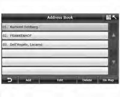
- touch "Add" to enter the search menu to search/add an address/POI to your address book.
- Click "Delete" to delete one entry from your address book.
- Click "On Map" to view the location of the address on the map.
- click "Edit" to go to the page "Address Book Edit" (Editing your address book).
Figure 6.9 Editing the address book
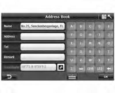
- Touch the field you want to change and, once the cursor is in that field, enter the data using the keyboard. Press "123" or "SYM" to change the input format.
Figure 10 Selecting a point of interest symbol
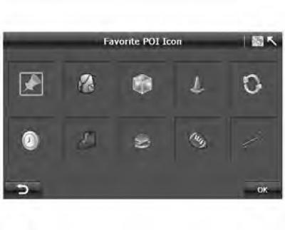
- Click
 in Figure 6.9 to go to the screen "POI Icon Selection" ("Selecting a point of interest symbol").
Switching between "day/night" modes
The A-Navi system allows you to manually or automatically adjust the map's color scheme to suit different lighting conditions during the day and at night.
Figure 6.10 Switching "Day/Night" modes
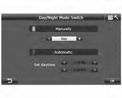
- When the mode is on "Manually" ("Manually"), you can switch between day and night map modes yourself. The manual switching function disables the automatic mode and vice versa.
- When the mode is on "Automatic" ("Automatically"), you must set daytime.
Daytime may start from "5:00-9:00" and end at "17:00-21:00".
6. Setting your home address
Figure 6.11 Settings
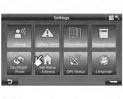
- Click "Set Home Address" ("Set home address") and go to the "Search" menu.
7. GPS status
Figure 6.12 GPS Status
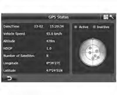
- On the screen "Settings" ("Settings") (figure 6.3) press the button "GPS Status" ("GPS Status") to display the GPS status screen (figure 6.12).
On the screen "GPS Status" ("GPS Status"), you can view the following information:
- 1. GPS active: GPS satellite signal is received. GPS inactive: GPS satellite signal is not received.
- 2. Satellite position: The location of the satellites relative to your current position.
Location information:
- 1. Date: GPS fix date, eg 13-02;
- 2. Time: GPS fix time (always shown in GMT), for example 15:20:34
- 3. Vehicle speed: GPS fix speed.
- 4. Altitude: GPS reference altitude.
- 5. HDOP: Horizontal Position Dilution of Precision
- 6. Number of satellites: 8
- 7. Longitude: GPS longitude, eg 8°34'27E
- 8. Latitude: GPS latitude, eg 47°24'51N
8. Language
Figure 6.13 Selecting a language
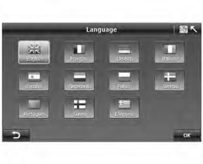
- You can select the language of the voice guidance and the program interface by clicking on the language icon.
- Click "OK" to return to the page "Settings" ("Settings").
9. Right/left hand drive cars
Figure 6.14 Settings_2
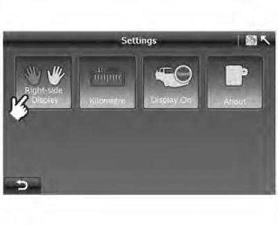
For better visibility, the A-Navi system provides different user interface layouts for right-hand/left-hand drive vehicles.
Figure 6.15 Left-hand drive
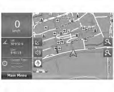
Figure 6.16 Right-hand drive
10. Unit of measurement
Figure 6.17 Settings_2
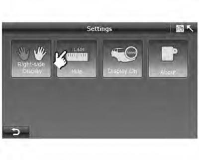
You can set the unit of distance measurement: kilometers or miles.
11. Display driving speed ON/OFF
Figure 6.18 Settings_2
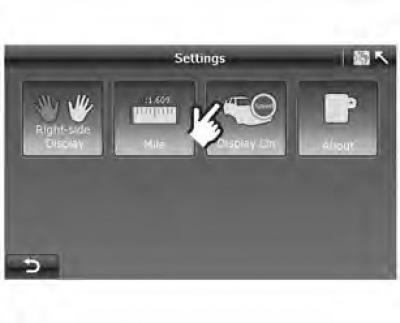
Typically, the vehicle's speed is displayed on the navigation map.
However, the vehicle speed is not always correct due to GPS signal deviation. This function allows you to turn on/off the speed display function.
If you see the symbol "Display On" ("Display on"), your vehicle's speed is not displayed. Click this button to turn on the speed display function, and vice versa.
12. About the system
Figure 6.19 About the program
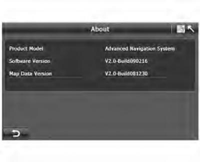
By clicking on the "About" button, you can view information about the A-Navi system:
- A. Model
- B. Software version
- C. Map version